|
1
|
|
|
2
|
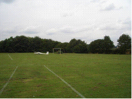
- DECISION to land
- SELECTION of field
- Search
- Wind*
- Size
- Slope
- Surface
- Seasons
- Obstructions
- EXECUTION of landing
- Circuit
- Approach
- Landing
- After landing
- Practice
|
|
3
|
- Met Office Form 214 - UK spot wind chart
- Write predicted wind speed and direction on map (useful for navigation)
- Note compass heading for into-wind
- Note position of the Sun for into-wind
- This will change as the day progresses, of course
- Write QFE on map/back of hand ?
|
|
4
|
- For early cross-countries when outside gliding range of Dunstable and
assuming an L/D of at least 34 (=K23):-
- make sure you are over landable terrain by 2000ft. i.e. not over built-up areas,
forests, regions of small or otherwise un-landable fields (often in
very hilly regions), expanses of water etc.
- by 1500ft choose a field and don’t let it get out of range
- (in weak lift you may be able to transfer to another field (but always
keep one in range)
- by 1000ft make a decision to land and do it - whatever comes !
- If you leave your altimeter on QFE Dunstable you will probably have an
additional margin for error locally
- More experienced pilots (i.e. those with a reasonable number of field
landings under their belts) will have a lower limit for ‘decision to
land’
- but they will always have suitable fields available
- You will probably know for yourself when you have reached this stage
but don’t chance it before.
|
|
5
|
- If you leave your altimeter on QFE-Dunstable you will probably have an
additional margin for error locally – but this is not certain
- If you reset your altimeter to QNH you might be able to relate it to
altitudes on the map
- Discuss !!!
- You have got to decide if/when to re-set the altimeter and to what (QFE
Dunstable is on your map/hand !!!)
- Your computer might give you height agl if it has a terrain database–
but beware !!!! Altimeter
definitely won’t.
- So - IGNORE the altimeter (or computer) below (say) 1000ft indicated -
or as appropriate for the region – and use your judgement of height to
use for circuit and landing.
|
|
6
|
- THIS IS PROBABLY GOING TO BE PRETTY IRRELEVANT SOON*
- You may have re-set your altimeter to 1013 to make sure you didn’t bust
a FL
- e.g. if you took off with 990mb QFE, you would ‘lose’ 690ft re-setting
to QNE (1mb = 30ft but I’m not
suggesting mental calcs in the air)
- You have got to decide if/when to re-set the altimeter and to what (QFE
Dunstable is on your map/hand !!!)
- * a) Daventry b) Transition level going up
|
|
7
|
- 1. Slow down to minimum sink speed -ish
- to give yourself maximum time in the air for searching
- 2. TURN DOWNWIND
-
(other things being equal)
- e.g. minsink speed of 45kts with15kts of wind implies:- into wind = 30kts : downwind = 60kts
- - you will have TWICE the number of fields to choose from !
- Try not to glide a long way to a good looking field if acceptable ones
are closer. It might not be as
good as it looks when you get there e.g. livestock.
- Do NOT glide a long way towards e.g.a built up area.
- Otherwise, when you get
there (now lower) you will have reduced options by 50%
|
|
8
|
|
|
9
|
- 5. Get a general impression of the terrain:-
- Hills and slopes (see later), forrests/fields/towns, power lines,
masts, other large obstacles
|
|
10
|
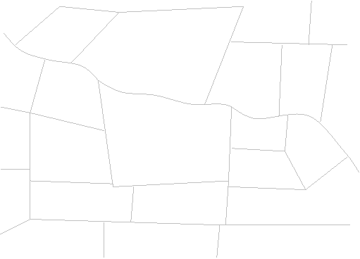
- You are looking for a field:-
- Long enough (possibly on the diagonal)
- With acceptable surface* (and no livestock)
- Level or uphill into wind (or at least with into wind component)
- With no major obstructions
- * If there are tramlines you will want to land along them (with headwind
component)
|
|
11
|
- Before take-off
- Write wind speed and direction on map
- Note compass heading for into-wind
- Note position of the Sun for into-wind
- This will change as the day progresses, of course
- During flight
- Keep a check on wind direction in relation to above by means of
- drift in thermals
- cloud shadows on the ground
- possibly, wind-socks/flags
- (if you’re lucky) smoke, ripples on water/crops, wind shadows on lakes
etc
- (poss) the wind arrow on your computer (but be circumspect)
- Approach & landing
- Wind backs as you descend (up to 30o anti-c/w)
- You don’t necessarily have to be dead into wind (unless it is very
strong) but you probably don’t want a tail wind component
|
|
12
|
|
|
13
|
- Near the coast
- Near hills
- In valleys
- (normally blows along valleys during the day, but katabatic winds in
the evening)
- Near fronts, cells, etc
- As the weather systems progress
|
|
14
|
- The perception of size depends on the field relative to surrounding
fields
- In a region of small fields (Wales?) a relatively larger field may look
big but is actually still small.
- In a region of large fields (East Anglia?) fields may look small but are
really big. A field which seems
relatively large is actually enormous!
|
|
15
|
- You need about 150 metres (yards) from reference point to stop in no
wind on a level field if approaching at the correct speed (assuming
normal wheel brake)
- The ref point will be some distance into the field – say 100metres –
depending on the height of the hedge
- So 250 metres is about the minimum
- 300 + meters would be good
- Power poles are about 80 to 100 metres apart
- Electricity Pylons are about 170 to 200 metres apart
- Dunstable a/f is about 500 x 400 m
- but remember a lot of the landings are UPHILL
|
|
16
|
- The required size will depend on
- Wind strength
- Type of glider (effectiveness of airbrakes, flaps)
- Slope
- Surface
- Obstructions on approach
- Skill of pilot !!!
|
|
17
|
- You CAN’T land downhill !
- Fly all round the field, if possible, to assess slope
- When you get on the ground, slope is often steeper than it looked from
the air
- Railway embankments (cuttings) are essentially level (also canals,
lakes)
- In extremity choose uphill - downwind
|
|
18
|
|
|
19
|
|
|
20
|
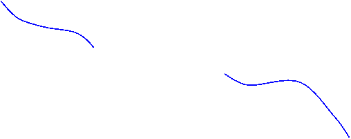
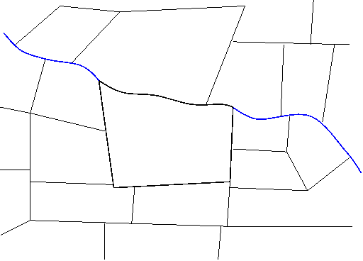
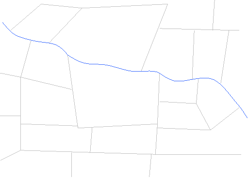
- Wiggly lines are almost certainly streams or ditches
- It is DOWNHILL towards water
- ALWAYS land over the wiggly line into the field
- i.e. so that the water is behind you when you stop
|
|
21
|
- It is downhill to water (lakes, rivers etc - but not necessarily canals
or reservoirs - normally identified by embankments)
- Try to see the general lie of the land
|
|
22
|
|
|
23
|
|
|
24
|
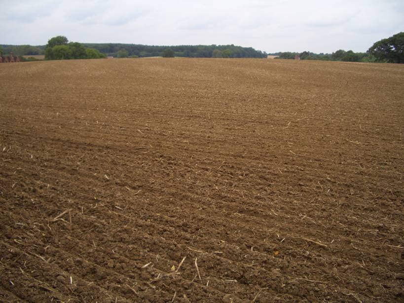
- COLOUR
- Green can be a snare and a delusion
- especially turquoise
- but otherwise not always
- Yellow is not normally worth the risk
- Brown is often good
|
|
25
|
- if the ground has been cultivated it will be relatively flat (not
necessarily level).
- tram lines (tractor lines/cultivation lines ) mean it is flat – no
holes, ridges, ditches, tussocks etc. since a plough and harrow has been
over it.
- HOWEVER the tramlines themselves will cause potential damage to the
glider u/c if you land across them – land as nearly as possible along
the tramlines, irrespective of exact wind direction
- the BEST fields have been cut for silage – big grass runways ! Try
landing where it is cut, not heaped-up.
|
|
26
|
- Harvested fields are usually OK
- i.e.stubble is normally OK *
- Mind the bales !!
|
|
27
|
- Rape – anything yellow is worth avoiding: turquoise green before it goes
yellow: rape stubble is almost as bad – looks ‘ragged’.
- Ridge & Furrow (lots of it locally) – will definitely wreck your
glider unless you are good enough to land along a ridge – few are !
- Long crop – see next slide
- Anything not a uniform colour shade
- gentle shading might be ok but not hard lines (->electric fences)
- Ragged looking fields – often grazing pasture or long crop damaged by
the wind, or rape
- Livestock – will eat your glider or trample on it
- Also the landowner will not be happy if you frighten valuable animals
|
|
28
|
- Become a student of agriculture (arable)
- Monitor the seasons and progress of the crops in various regions
- Short crop is no problem and little damage is done by the landing
- not necessarily true of the retrieve unless you are careful
- Long crop will wreck your glider because
- either the leading edges will be damaged: and/or
- you will ground loop and break off the tail
- How do you know how long it is?
|
|
29
|
- It is too long if:-
- you see ‘ripples’ blowing across the field
- you can’t see the bottom of the hedges
- the tramlines seem deep (deep shadows)
- the crop seems level with the top of the hedges, or
- the field looks like a tray which is full-up
|
|
30
|
- You can see more earth (brown) through the green of short crop
- As it gets longer the brown earth disappears
|
|
31
|
- See http://www.fieldselection.co.uk for pictures of various crops in
different months of the year from the air and from the ground
- The units on the markers are tens of centimeters (decimeters). So ‘5’ is 50 cms which is about 1’8”
|
|
32
|
- Mainly electricity pylons
- Masts – particularly anemometer masts – difficult to see, anchor points
small, not on charts
- Woods and other obstructions may influence whether you choose left or
right hand circuit
- Beware curl-over from trees, buildings
- Other aircraft (gliders going for the same field ? in a comp?)
|
|
33
|
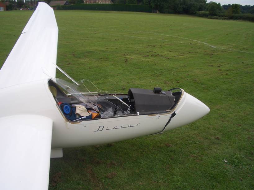
- Trees in the hedge line over which you are approaching are VERY
dangerous
- you tend to concentrate on the reference point and ignore the wing
tips
- if you catch a wing you will probably roll inverted, crash and
possibly die !
|
|
34
|
|
|
35
|
|
|
36
|
|
|
37
|
- Wires – power/telephone
- Trees (a wood), lampposts, power wires etc will all set you high and a
long way into the field effectively reducing its length
|
|
38
|
- Fences, inc electric
- Beware any change in shade/texture between two parts of a field. Also
water troughs may indicate a fence. Beware tracks converging on a
point.
- Power wires
- They tend to radiate out from buildings
- Have ‘eye’ shapes around the posts in the cultivation
- Footpaths, vehicle tracks, ditches – any line feature
- Livestock – don’t land there
|
|
39
|
- IDEALLY you are looking for a field:-
- with cultivation lines, into wind
- adequate length
- uphill (or level)
- with acceptable surface
- without obstructions on the approach (or circuit or in field)
|
|
40
|
- Consider convenience of access for the trailer/to the farmhouse
- Assume other gliders have got it right !
|
|
41
|
- It is VERY easy to lose your chosen field !
- When you have chosen it, look for an outstanding landmark and its
location in relation to your field
- e.g. distinctive wood, house, road junction etc
- Then when you take you eyes off the field, or turn away from it for
positioning to high key, you will be able to pick it up again
|
|
42
|
- Do not forget to monitor speed at all times
- It is VERY easy to forget this
- IGNORE ALTIMETER
- Set up normal circuit
- High key
- You may have to manoeuvre away from the field to get here – that’s
why you have ‘marked’ it
- DON’T make High Key too close !!!!! (See below re relative sizes)
- Low key
- Diagonal leg
- Base leg
- Final turn
|
|
43
|
- Do not hesitate to use airbrakes to adjust height at any stage
- Plan circuit to avoid areas of curl over on the approach if possible
- Pick a final turn point early in the downwind leg, while still high, and
‘mark’ it (e.g. house, X-roads, centre of a field)
|
|
44
|
- Do NOT put the base leg too close*
- Maybe two or three fields back with appropriate height
- This will give time to set up a nice stabilised approach
- If you are too high, do a repeat base leg
|
|
45
|
- It is easy to make the base leg too close because:-
- The field is probably small compared with your home airfield and
relatively speaking your base leg looks correct although it is
actually too close (similarly High Key, above)
- At Dunstable our base legs are usually rather close anyway because of
topographical features
- At Dunstable we tend to learn circuits off the winch – which are
usually therefore too low and close-in !!!
- Use FULL a/b to correct height if required, then close/lock
- Can you sideslip your glider safely?
- No low turns !!!!!!!
|
|
46
|
- Correct SPEED is critical
- Be VERY cautious about trees in the hedge over which you are approaching
- Watch out for curl over from trees or buildings or lift/sink from nearby
topology
- Be sure to recognise any undershoot early and take decisive action
|
|
47
|
- By this stage you are committed !!!!
- Make sure you do not undershoot but use full airbrake once you’re sure
to clear obstructions
- Fully held off !!!!!!
- Judicious use of wheel brake
- Why ground run further than necessary – might be a hole
- But in extremity put it down, use the wheel- brake, and even ground loop
- You will probably break the glider but better than injury or death
- In any case it is better to hit the far hedge at 10kts than the near
one at 55kts. The former might
injure but the latter may kill.
|
|
48
|
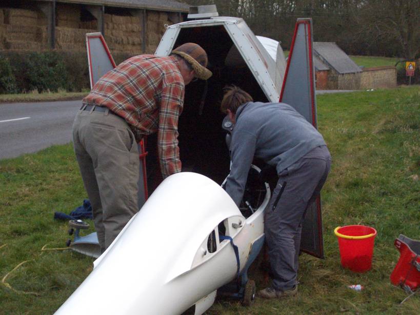
- After landing on a slope you may need to hold the brake on before you
can get out – a bungee is useful
- Secure glider, take valuables with you
- Establish precise location - ?gps lat & long
- Double check – you don’t want your crew going to the wrong place – it
has been known!
- Consider D&D cell
- Contact LGC – always
- Contact retrieve crew directly if desired
|
|
49
|
- Contact land owner to get permission to recover glider – be apologetic,
humble, grateful … you are an uninvited guest
- – act accordingly
- Could offer a complimentary flight at LGC (cards available)
- And/or follow-up with a thank you letter (bottle of wine?)
- Meet crew on appropriate highway
- Minimise damage to crop
- Close all gates afterwards
- See BGA document which cover legalities, insurance, compensation etc
- (on their website: Info for Clubs & Members >Cross Country &
Competitions > Field Landing > Guidance following a field landing)
|
|
50
|
- Damage covered by insurance
- Do not admit liability
- Do not pay anything
- Exchange addresses and insurance details
- Take photos
- Contact your insurers asap
- Landing fee ? Fully covered in BGA website document. (poss a small sum
<=£20, refer to NFU agreement)
|
|
51
|
- The BGA say:-
- that you cannot legally be prevented from leaving a property or taking
your glider with you
- That you could be expelled by force – but no more than is reasonably
necessary and only after being asked to leave
- Your glider cannot be confiscated or impounded – which would be
theft. If you are prevented from
reasonably retrieving your aircraft it becomes their responsibility –
point out its value.
- If you are threatened – call the police.
They will not be interested in trespass (which is a civil wrong)
but they will get involved in a case of threatening behaviour which may
be a criminal offence.
- ALWAYS STAY CALM AND ACT POLITELY
|
|
52
|
- While soaring locally practice choosing fields
- Note carefully where the field is (prob best with ¼ million map)
- After landing back, drive out to the field and see what it would have
been like
- This can be very confidence giving (?instructive)
|
|
53
|
- Briefing – what’s going to happen?
- We are not going to (intentionally) touch down but may get to the
round-out
- 500 foot rule
- Un-obstructed exit from field
- Engine blips on descent
|
|
54
|
|

 Notes
Notes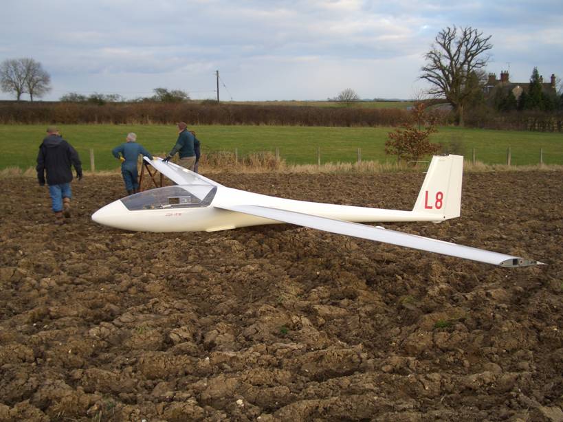